North and Central Highlands, Kenya
Limited and unreliable transportation options make access to basic health care and other essential services a major problem for the people of these regions. They have significant health challenges such as malaria, HIV/AIDS and rapid population growth. Traditional practices common to male dominated societies including polygamy, female genital mutilation and female subservience present further challenges for health and reproductive education.
The well being of Kenyans and the environment is rapidly deteriorating. Overpopulation is a predominant factor in causing unnecessary suffering and poverty and also contributes to an unbalanced and unsustainable ecological environment.

The Regions
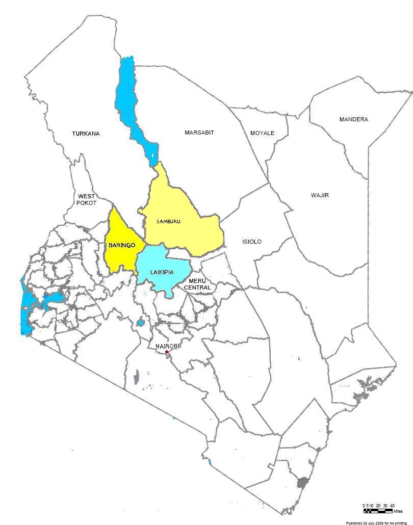
Samburu
Just north of the equator in Northern Kenya is the Samburu region. It is approximately 8,000 square miles of a diverse landscape of high-altitude forests, open plains and desert. The remote lowlands are hard to reach and are hot and dry with scrub as the primary vegetation. There are about 200,000 people living in the area mostly Samburu but also Turkana, Somali and Rendille communities. Only 3% of the land is cultivated for crops.
Laikipia
The Laikipia region lies in the north part of Kenya in the northern Rift Valley. It is located along the equator and has a temperate climate with a rainy season and a dry season. Most of the 420,000 inhabitants are Kikuyu (approximately 60%), with the remainder being other ethnic groups such as Masai, Samburu, Meru, Borana, Kelenjin, Somali, Turkana and Pokot. It is about 3,670 square miles, or twice the size of Rhode Island. Most of the Laikipia people live a semi-nomadic life, herding goats, sheep and cattle. The main foods are meat, milk and blood, though this is changing as maize is now also a staple. They live in extreme poverty, subsisting of less than $1 US per day resulting in a restricted diet. Natural resources such as water and grazing space are limited, causing inter-group conflict. Parts of Laikipia are harsh and inhospitable. Poor road infrastructure in the region cause travel between urban centers and outlying areas extremely difficult and time consuming.
Baringo
Baringo is supported by the RAE trust clinic. Baringo lies in a vast bowl flanked by spectacular mountains and rocky escarpments that rise to the east and west, reaching over 1500m (4,920 ft) above the valley floor.The average temperature in this semi–arid, low-lying land is 35 degrees Centigrade (100 degrees Fahrenheit). The average rainfall is only 640 mm (3.9 inches) with most of the rain falling from May to August, with some in November.Three different tribes of people live around Lake Baringo: the Njemps who are related to the Masai, the Pokot tribe, and the Tugen who are part of the larger Kalenjin group of tribes.
